


The Global Real-Time Ocean Forecast System (Global RTOFS) is based on an eddy resolving 1/12° global HYCOM (HYbrid Coordinates Ocean Model) (Chassignet et al., 2009) and is part of a larger national backbone capability of ocean modeling at NWS in a strong partnership with US Navy. The Global RTOFS ocean model became operational 25 October 2011.
In 2020 the Global RTOFS ocean model was upgraded to Version 2.0, which introduces a high-resolution ocean data assimilation capability to the forecast system for the first time (Garraffo, et al., 2020). Global RTOFS provides predictions for up to eight days of ocean currents, salinity, temperature and sea ice conditions around the world.
The NOAA announcement regarding the upgraded system is here:
NOAA upgrades flagship ocean forecasting system
The Global RTOFS ocean model, based on an earlier operational Atlantic RTOFS ocean model (Mehra and Rivin. 2010), runs once a day and produces a nowcast and 8 days of forecasts. The Global RTOFS model is initialized with RTOFS-DA (based on NCODA), a 3D multi-variate data assimilation methodology (Cummings, 2005). The data types assimilated include in situ profiles of temperature and salinity from a variety of sources and remotely sensed SST, SSH and sea-ice concentrations. The operational ocean model configuration has 41 hybrid layers and a horizontal grid size of (4500 x 3298) . The grid has an Arctic bi-polar patch north of 47°N and a Mercator projection south of 47°N through 78.6°S (Figure 1 below). The bathymetry minimum depth is 5 m with open Bering Straits, designed to be compatible with CICE. The potential temperature is referenced to 2000 m depth (sigma-2) and the first level is fixed at 1 m depth.
The Global RTOFS ocean model is coupled to the Community Ice CodE (CICE) Version 4. CICE is a computer code developed through years of community collaborations, which solve a collection of mathematical equations that represent the physical processes that occur during sea ice evolution: growth, melting, and movement of sea ice, along with the snow and melt water carried with it. CICE is maintained by the CICE Consortium.
The forecast system is forced with 3-hourly momentum, radiation and precipitation fluxes from the operational Global Forecast System (GFS) fields.
Results include daily volume and 3 hourly surface fields in netCDF format with CF conventions. Some surface fields in GRIB format are also generated for internal use at NWS.
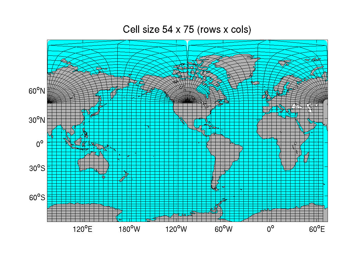 Figure 1: Grid for the global ocean forecast system with each cell
representing 54th row and 75th column of the grid.
Figure 1: Grid for the global ocean forecast system with each cell
representing 54th row and 75th column of the grid.
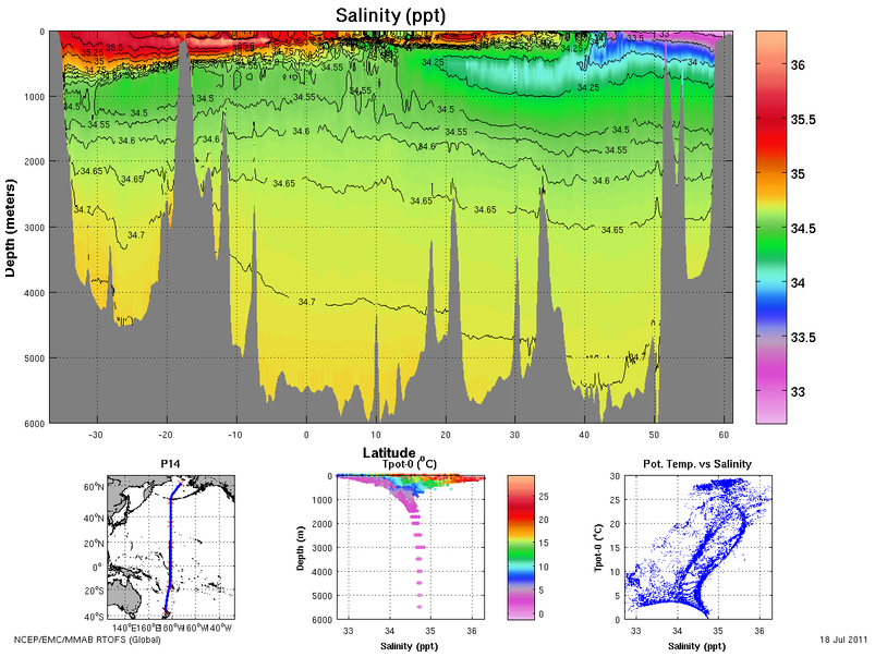 Figure 2: Salinity in the Global RTOFS model along the meridional P-14 WOCE section.